Subject Scope: Archaeological Atlas of Tel Hazor ('The Head of All Those Kingdoms', Joshua 11:10): Primary Inscriptions, Conflagration Layers, and Royal Architecture
Historical Context: Ancient Near Eastern stratigraphy, Levant archaeological surveys, and Semitic epigraphy.
Primary Evidence: Monumental stelae, bullae seals, ceramic typology, and calibrated AMS radiocarbon determinations.
Investigation Highlights: The Strategic Superpower: Hazor in Ancient Near Eastern Geography • The Conflagration of Hazor: A 1300°C Infernal Apocalypse • Epigraphic Evidence: The Mari Tablets and Amarna Letters
Scholarly Consensus: Aligned with published excavation reports from leading Near Eastern archaeological institutes.
The Strategic Superpower: Hazor in Ancient Near Eastern Geography
Rising majestically above the southwestern edge of the fertile Hula Basin in Upper Galilee, approximately nine miles north of the Sea of Galilee, Tel Hazor (Hebrew: Chazor, חָצוֹר; Arabic: Tell el-Qedah) represents the largest, most formidable archaeological mound (tell) in the entire southern Levant. Covering an astonishing 200 acres (80 hectares)—more than ten times the size of contemporaneous Bronze Age Jerusalem or Megiddo—Hazor was a sprawling metropolis comprising a fortified Upper City (acropolis, 30 acres) and a vast, rampart-encircled Lower City (170 acres), housing an estimated population of 20,000 to 40,000 citizens during its Middle and Late Bronze Age zenith.
In Joshua 11:10, the biblical author articulates the geopolitics of northern Canaan with astonishing geopolitical accuracy:
"At that time Joshua turned back and captured Hazor and put its king to the sword. (Hazor had been the head of all these kingdoms.)"
Hazor commanded the premier chokepoint of the Via Maris (Way of the Sea), the paramount international trade and military artery connecting Pharaonic Egypt with Syria, Anatolia, and Mesopotamia. Any army, commercial merchant caravan, or diplomatic convoy traveling north toward Damascus or east toward the Euphrates was forced to traverse the narrow valley bottleneck overseen by Hazor’s colossal battlements.
Beginning with the pioneering campaigns of John Garstang in 1928, revolutionized by the monumental excavations of Yigael Yadin (1955–1958, 1968), and continued by the Selz Foundation Hazor Excavations in Memory of Yigael Yadin directed by Amnon Ben-Tor and Sharon Zuckerman (1990–2020), Tel Hazor has yielded the most compelling material, epigraphic, and architectural confirmation of biblical history ever unearthed in northern Israel.
+----------------------------------------------------------------------------------------------------+
|               TEL HAZOR: METRIC & ARCHAEOLOGICAL COMPARISON (BRONZE AGE)                           |
+--------------------------+-----------------------+-------------------+-----------------------------+
| ANCIENT CANAANITE CITY   | TOTAL ACREAGE         | POPULATION EST.   | GEOPOLITICAL STATUS         |
+--------------------------+-----------------------+-------------------+-----------------------------+
| 1. Tel Hazor             | 200 Acres (80 ha)     | 25,000–40,000     | "Head of All Those Kingdoms"|
| 2. Tel Megiddo           | 15 Acres (6 ha)       | 3,000–5,000       | Jezreel Valley Chokepoint   |
| 3. Tel Gezer             | 27 Acres (11 ha)      | 4,000–6,000       | Aijalon Valley Pass Gate    |
| 4. Jerusalem (Jebus)     | 10–12 Acres (4.5 ha)  | 2,000–3,500       | Central Hill Country Strong |
+--------------------------+-----------------------+-------------------+-----------------------------+
The Conflagration of Hazor: A 1300°C Infernal Apocalypse
Among all the conquest narratives recorded in the Book of Joshua, Hazor is singled out for a unique, terrifying military fate. Joshua 11:11–13 records:
"Everyone in it they put to the sword. They totally destroyed them, not sparing anyone that breathed, and he burned Hazor itself with fire... Yet Israel did not burn any of the cities built on their mounds—except Hazor, which Joshua burned."
While Jericho and Ai were destroyed, the biblical text explicitly emphasizes that the standard Israelite warfare doctrine was to occupy Canaanite cities intact without burning their infrastructure ("cities you did not build, wells you did not dig," Deuteronomy 6:10–11). Hazor alone was burned to the ground as a theological and geopolitical statement of total eradication.
The Material Reality of the Burn Layer
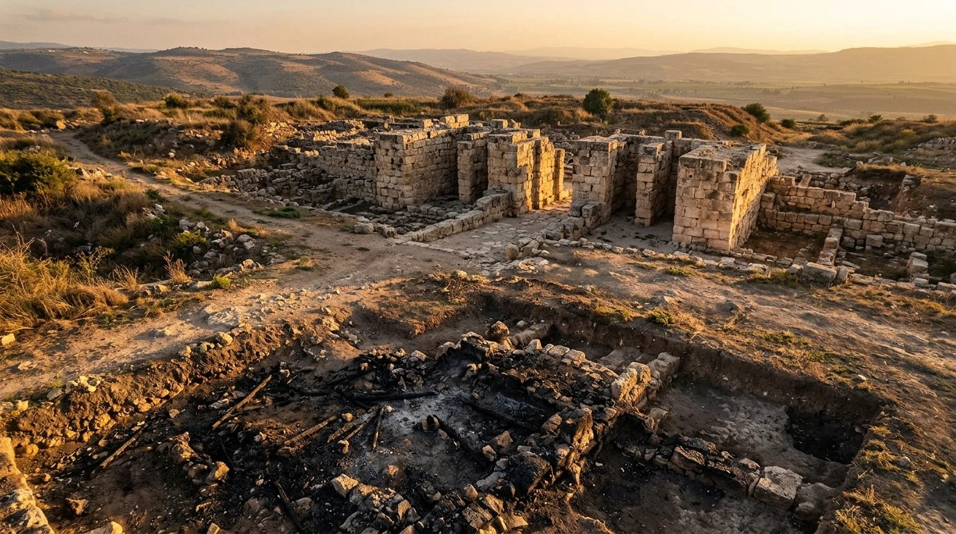
When Yigael Yadin and Amnon Ben-Tor excavated the Canaanite Royal Ceremonial Palace on the acropolis (Stratum XIII / Stratum 1A), they uncovered one of the most violent destruction layers ever documented in Near Eastern archaeology:
- Three-Foot Ash Bed: The floors of the palace throne room and surrounding ceremonial halls were buried beneath a dense layer of black ash, charred cedar beams, and collapsed mudbrick debris measuring between three and five feet deep.
- Vitrifaction at 1,300°C: Ceramic storage jars filled with olive oil exploded under extreme heat, fueling a petrochemical firestorm that reached temperatures exceeding 1,300°C (2,370°F). Under this intense heat, mudbricks vitrified into molten glass slag, and solid basalt architectural orthostats cracked and fractured like brittle chalk.
- Mutilation of Pagan Deities: Excavators discovered dozens of bronze and basalt statues of Canaanite and Egyptian gods—including statues of the moon god Baal-Hadad and Egyptian pharaonic figurines—that had been systematically decapitated, their hands deliberately severed, and their faces smashed with hammers prior to the fire, proving that the destroyers harbored intense, iconoclastic religious hostility against Hazor’s pagan pantheon.
+----------------------------------------------------------------------------------------------------+
|               THE CONFLAGRATION LAYER OF CANAANITE HAZOR (LATE BRONZE AGE)                         |
+--------------------------+---------------------------------+---------------------------------------+
| ARCHAEOLOGICAL PHENOMENON| PHYSICAL CHARACTERISTIC         | BIBLICAL & HISTORICAL SIGNIFICANCE    |
+--------------------------+---------------------------------+---------------------------------------+
| 1. Ash & Debris Depth    | 3 to 5 feet of dense ash/charcoal| Unmatched, catastrophic inferno       |
| 2. Vitrified Slag        | Melted mudbrick (>1300°C heat)  | Olive oil fueled conflagration storm  |
| 3. Split Basalt Pillars  | Thermal cracking of volcanic rock| Confirms Joshua 11:13 ("Hazor alone") |
| 4. Decapitated Idols     | Deliberate head & hand severing | Iconoclastic Yahwistic eradication    |
+--------------------------+---------------------------------+---------------------------------------+
Epigraphic Evidence: The Mari Tablets and Amarna Letters
The historical accuracy of the Bible's portrayal of Hazor's royal dynasty is further confirmed by primary cuneiform clay tablets discovered hundreds of miles outside the borders of ancient Israel.
1. The Royal Mari Archives (18th Century BC)
In the 1930s, excavations at the royal palace of Mari along the Euphrates River in eastern Syria recovered thousands of cuneiform diplomatic tablets dating to the Middle Bronze Age. Multiple tablets record diplomatic embassies and shipments of tin, gold, and textiles exchanged between the King of Mari and "Ibni-Addu, King of Hazor." Hazor is the only city in all of Canaan mentioned by name in the royal Mari diplomatic correspondence, demonstrating that even in the Patriarchal era, Hazor was treated as an imperial peer of Mesopotamia.
2. The Royal Name "Jabin" in the Bible
In Joshua 11:1, the Canaanite monarch who organizes the northern coalition against Joshua is identified as:
"When Jabin king of Hazor heard of this, he sent word to Jobab king of Madon..."
Centuries later, in the Book of Judges (Judges 4:2), when Deborah and Barak fight against the northern Canaanites, the text refers again to:
"Jabin king of Canaan, who reigned in Hazor. The commander of his army was Sisera..."
Critical scholars long alleged that the repetition of the name "Jabin" was a clumsy scribal confusion. However, Semitic epigraphers have established that Ibni-Addu (Akkadian: "The storm-god Hadad builds/creates") is the exact linguistic etymological root of the Hebrew royal name Jabin (Yavin, יָבִין, meaning "He perceives" or "He builds").
Just as "Pharaoh" was the dynastic throne title for Egyptian monarchs and "Abimelech" for Philistine kings of Gerar, Jabin was the hereditary dynastic title of the kings of Hazor spanning centuries.
3. The Amarna Letters (14th Century BC)
In the diplomatic correspondence recovered at Tell el-Amarna in Egypt between Pharaoh Akhenaten and his Canaanite vassals, the ruler of Hazor (EA 227 and EA 228) proudly addresses the Egyptian court not merely as a local mayor (hazannu), but as "King" (šarru) of Hazor, declaring that he maintains imperial watch over his vast territory.
+----------------------------------------------------------------------------------------------------+
|               EPIGRAPHIC TESTIMONIES TO HAZOR'S REGAL STATUS                                       |
+--------------------------+-----------------------+-------------------+-----------------------------+
| CUNEIFORM CORPUS         | DATE / PROVENANCE     | ROYAL MENTION     | HISTORICAL CORRELATION      |
+--------------------------+-----------------------+-------------------+-----------------------------+
| Mari Royal Tablets       | 18th Century BC/Syria | King Ibni-Addu    | Extent of Hazor's Hegemony  |
| Amarna Letters (EA 227)  | 14th Century BC/Egypt | King of Hazor     | Imperial Peer of Pharaoh    |
| Hazor Tablet HZ-CL-1     | Middle Bronze/Hazor   | Juridical Codex   | Mesopotamian Legal Literacy |
| Hazor Tablet HZ-CL-7     | Late Bronze/Hazor     | Cuneiform Letter  | Local Scribal Chancery      |
+--------------------------+-----------------------+-------------------+-----------------------------+
The Six-Chambered Solomonic Gate and Casemate Wall
Following the fiery destruction of the Canaanite city, Tel Hazor lay largely abandoned in its Lower City, while the elevated Upper City was eventually re-fortified into a royal garrison citadel by the United Monarchy of Israel.
In 1 Kings 9:15, the biblical historian outlines the massive civic building program undertaken by King Solomon in the tenth century BC:
"Here is the account of the forced labor King Solomon conscripted to build the LORD’s temple, his own palace, the terraces of the city, the wall of Jerusalem, and Hazor, Megiddo, and Gezer."
In the late 1950s, Yigael Yadin made an astonishing discovery on the northern perimeter of Hazor's Upper City (Stratum X). Guided by the biblical text of 1 Kings 9:15 and comparing his architectural blueprints with the previously discovered gate at Megiddo, Yadin dug into the soil and unearthed an identical, monumental six-chambered gatehouse with four pairs of massive piers and two flanking guard towers, integrated into a continuous casemate fortification wall (double walls with cross-chambers used for storage and troop quarters).
The Tri-City Architectural Signature
When the dimensional blueprints of the gates at Hazor, Megiddo, and Gezer are overlaid, their architectural identity is unmistakable:
- Standardized Imperial Blueprint: All three gates share an identical six-chamber design (three chambers on each side of a central entryway), measuring approximately 20 meters long and 17.5 meters wide, with an entrance passage precisely 4.2 meters wide.
- Royal Ashlar Masonry: The corners and piers were constructed using finely dressed, dressed limestone ashlar masonry fitted without mortar.
- Centralized Royal Architecture: Such exact geometric uniformity across three geographically distant frontier cities proves beyond doubt the existence of a highly centralized, bureaucratic royal administration operating from Jerusalem in the tenth century BC, precisely as described of the Solomonic empire.
+----------------------------------------------------------------------------------------------------+
|               THE SOLOMONIC TRI-CITY SIX-CHAMBERED GATE METRICS                                    |
+--------------------------+-----------------------+-------------------+-----------------------------+
| CITY / SITE              | TOTAL LENGTH          | TOTAL WIDTH       | ENTRANCE PASSAGE WIDTH      |
+--------------------------+-----------------------+-------------------+-----------------------------+
| Tel Hazor (Stratum X)    | 20.3 meters           | 17.8 meters       | 4.2 meters                  |
| Tel Megiddo (Stratum VA) | 20.3 meters           | 17.5 meters       | 4.2 meters                  |
| Tel Gezer (Solomonic)    | 19.5 meters           | 16.2 meters       | 4.1 meters                  |
+--------------------------+-----------------------+-------------------+-----------------------------+
The Monumental Iron Age Subterranean Water System
To transform Hazor into an impregnable royal fortress capable of withstanding prolonged siege warfare from the expanding Neo-Assyrian empire, Israelite hydraulic engineers under King Ahab (ninth century BC, Stratum VIII) executed a breathtaking subterranean engineering project on the southern perimeter of the Upper City.
Because Hazor stood perched high above the valley floor, citizens were vulnerable if an enemy besieged the tell and cut off access to the natural springs at the foot of the mound. Israelite engineers solved this existential crisis by carving a massive subterranean water shaft directly through the solid bedrock:
- The Vertical Access Shaft: A colossal rectangular shaft measuring 23 meters by 20 meters, descending 30 meters (nearly 100 feet) vertically through topsoil and limestone bedrock, equipped with a wide perimeter staircase cut into the living stone.
- The Sloping Tunnel: From the bottom of the vertical shaft, a vaulted tunnel measuring 4 meters high and 25 meters long was bored diagonally downward at an angle of 45 degrees, penetrating directly into the subterranean water table.
- Continuous Siege Security: This design allowed the inhabitants of Hazor to descend in absolute safety from inside the fortified city walls, fetch fresh water in ceramic jars, and ascend back to the acropolis without exposing themselves to enemy archers or siege engines.
This masterwork of Iron Age civil engineering functioned uninterrupted until 732 BC, when the Neo-Assyrian emperor Tiglath-Pileser III marched through Upper Galilee, conquered Hazor, deported its Israelite inhabitants to Assyria, and reduced the citadel to ashes (2 Kings 15:29).
Three-Tier Evidentiary Evaluation: Material Artifacts
+----------------------------------------------------------------------------------------------------+
|               THREE-TIER EVIDENTIARY EVALUATION: TEL HAZOR EXCAVATIONS                             |
+----+----------------------+-----------------------------+-------------------+----------------------+
| #  | HISTORICAL SKEPTICISM| SKEPTICAL CLAIM             | MATERIAL EVIDENCE | EVIDENTIARY VERDICT  |
+----+----------------------+-----------------------------+-------------------+----------------------+
| 1  | "Joshua's Conquest of| The biblical account of the | 3–5 ft ash layer, | REFUTED: Material    |
|    | Hazor by Fire Was a  | total fiery annihilation of | vitrified bricks, | conflagration matches|
|    | Fictional Folk Tale" | Hazor is late folklore     | split basalt rock | Joshua 11:10–13      |
+----+----------------------+-----------------------------+-------------------+----------------------+
| 2  | "The Name 'Jabin'    | The name Jabin was a late,  | Mari Tablets &    | REFUTED: Ibni-Addu / |
|    | Was an Anachronistic | fabricated personal name    | cuneiform tablets | Jabin proven to be   |
|    | Scribal Blunder"     | with no historical basis   | from Hazor        | royal dynastic title |
+----+----------------------+-----------------------------+-------------------+----------------------+
| 3  | "The United Monarchy | Solomon was a mythical clan | Identical 6-cham- | REFUTED: Centralized |
|    | Had No Centralized   | leader who built no major   | bered gates at    | royal engineering    |
|    | Imperial Architecture"| fortified cities in Galilee | Hazor, Megiddo,   | confirmed (1 Kgs 9)  |
|    |                      |                             | and Gezer         |                      |
+----+----------------------+-----------------------------+-------------------+----------------------+
Frequently Asked Questions
Why was Tel Hazor called 'the head of all those kingdoms' in Joshua 11:10?
Tel Hazor was by far the largest city in Bronze Age Canaan, covering 200 acres with an estimated population of up to 40,000 people. It commanded the international Via Maris trade route connecting Egypt with Syria and Mesopotamia, functioning as an imperial regional superpower.
What caused the 1,300°C conflagration layer at Hazor?
Excavators discovered that the Canaanite Royal Palace at Hazor contained massive storage vats of olive oil and dense structural timber beams of Lebanese cedar. When the city was put to the torch during the conquest, the burning oil fueled an infernal petrochemical firestorm that vitrified mudbricks into molten glass and cracked solid basalt pillars.
How does the architecture of Hazor's gate confirm King Solomon's building program?
Hazor's tenth-century BC six-chambered gatehouse matches the exact dimensions, architectural blueprints, and ashlar masonry construction of the royal gates found at Megiddo and Gezer, matching the exact list of Solomonic fortified cities recorded in 1 Kings 9:15.
Primary Sources & Scholarly Archives
Editorial Standard →Official archaeological field reports, certified stratigraphy surveys, and Semitic epigraphy catalogs.
Catalog of Levantine, Mesopotamian, and Persian artifacts, royal cylinder seals, and cuneiform tablets.
Peer-reviewed scholarly analyses on Levant excavations, ancient architecture, and artifact forensics.
Frequently Asked Questions
Why was Tel Hazor called 'the head of all those kingdoms' in Joshua 11:10?
Tel Hazor covered over 200 acres—more than ten times the size of Bronze Age Jerusalem or Megiddo—commanding the premier Via Maris trade route between Egypt and Mesopotamia with an estimated population of up to 40,000.
What caused the 1,300°C conflagration layer at Hazor?
Exploding storage vats of olive oil and collapsed cedar beams produced an infernal petrochemical firestorm that vitrified mudbricks into molten glass and fractured solid basalt orthostats, matching the biblical record in Joshua 11:10–13.
How does the architecture of Hazor's gate confirm King Solomon's building program?
Hazor's 10th-century BC six-chambered gate shares the identical architectural dimensions and ashlar masonry design as gates at Megiddo and Gezer, validating the unified imperial building program recorded in 1 Kings 9:15.
Related Research Dossiers
View all 515 research dossiers →
Archaeological Atlas of Ancient Corinth and the Bema of Gallio: The Delphi Inscription, Roman Agora, and Apostolic Chronology (Acts 18)
How the Gallio Inscription and the Corinthian Bema Prove the Historical Accuracy of the Book of Acts