Subject Scope: Archaeological Atlas of Tel Gezer in the Shephelah: The Gezer Calendar, Solomonic Royal Gate, and Canaanite Standing Stones
Historical Context: Ancient Near Eastern stratigraphy, Levant archaeological surveys, and Semitic epigraphy.
Primary Evidence: Monumental stelae, bullae seals, ceramic typology, and calibrated AMS radiocarbon determinations.
Investigation Highlights: The Sentinel of the Shephelah: Topography of Tel Gezer • The 1908 Gezer Calendar: Paleo-Hebrew Agricultural Literacy • The Six-Chambered Solomonic Gate and Casemate Wall
Scholarly Consensus: Aligned with published excavation reports from leading Near Eastern archaeological institutes.
The Sentinel of the Shephelah: Topography of Tel Gezer
Perched strategically upon an elevated limestone saddle in the northern Shephelah (Judean foothills), approximately 18 miles west of Jerusalem and 5 miles southeast of modern Ramla, ancient Tel Gezer (Hebrew: Gezer, גֶּזֶר; Arabic: Tell el-Jazari) commanded the most vital crossroads of central Palestine. Gezer stood at the precise intersection of two supreme international trade highways:
- The Maritime Trunk Road (Via Maris): Connecting Egypt with Lebanon and Syria along the Mediterranean coastal plain.
- The Ascent of Beth-Horon: The primary mountain pass ascending from the coastal plain through the Valley of Aijalon directly up to Gibeon, Bethel, and Jerusalem in the Judean hill country.
From the summit of Tel Gezer (750 feet above sea level), watchmen enjoyed an unobstructed 360-degree panoramic vista across the coastal plain all the way to the Mediterranean coastline at Jaffa (Joppa) to the west, and the steep terraced slopes of the Judean highlands to the east. Any foreign army approaching Jerusalem from the Mediterranean coast had to march directly beneath Gezer's fortified ramparts.
Excavated successively by R.A.S. Macalister for the Palestine Exploration Fund (1902–1909), re-evaluated by William G. Dever for the Hebrew Union College (1964–1974), and recently excavated by the Tandy Archaeological Research Institute directed by Steven Ortiz and Samuel Wolff (2006–2017), Tel Gezer has yielded foundational material artifacts confirming Israel's biblical history.
+----------------------------------------------------------------------------------------------------+
|               STRATEGIC INTERSECTIONS COMMANDED BY TEL GEZER                                       |
+--------------------------+-----------------------+-------------------+-----------------------------+
| HIGHWAY / CORRIDOR       | ROUTE GEOGRAPHY       | DESTINATION       | MILITARY SIGNIFICANCE       |
+--------------------------+-----------------------+-------------------+-----------------------------+
| 1. Via Maris (Coast)     | Coastal Plain Sharon  | Egypt <-> Syria   | International trade & troop |
|                          |                       |                   | movements                   |
| 2. Aijalon Pass          | Valley of Aijalon ->  | Jerusalem /       | Direct military approach to |
|    (Beth-Horon Ascent)   | Central Hill Country  | Judean Acropolis  | the Davidic capital         |
| 3. Valley of Sorek Pass  | Shephelah Valleys     | Philistine Gath   | Frontier border between     |
|                          |                       | & Ekron           | Israel and Philistines      |
+--------------------------+-----------------------+-------------------+-----------------------------+
The 1908 Gezer Calendar: Paleo-Hebrew Agricultural Literacy
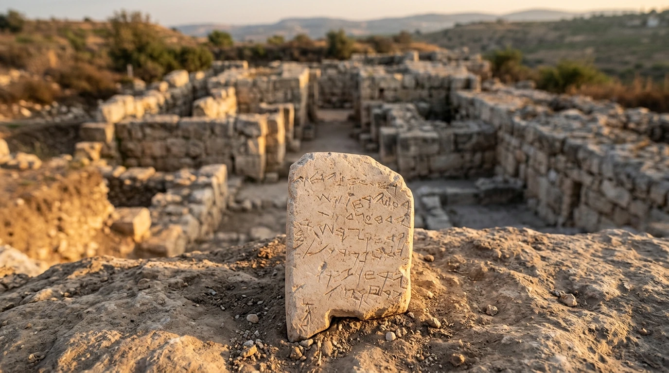
In September 1908, during excavations on the western slopes of Tel Gezer, Irish archaeologist R.A.S. Macalister made one of the most famous epigraphic discoveries in Near Eastern history: a small, rectangular soft limestone tablet measuring just 4.4 inches high, 2.8 inches wide, and 0.6 inches thick, inscribed in seven lines of archaic Paleo-Hebrew / Phoenician script: the Gezer Calendar.
Dated stratigraphically and paleographically to the tenth century BC (the era of King David and King Solomon), the tablet is written in poetic metric rhythm, detailing the twelve agricultural months of the Israelite calendar year:
+----------------------------------------------------------------------------------------------------+
|               THE GEZER CALENDAR INSCRIPTION (10TH CENTURY BC)                                     |
+----------------------------------------------------------------------------------------------------+
| ARCHAIC PALEO-HEBREW TRANSLITERATION & TRANSLATION:                                                |
|                                                                                                    |
| Line 1: ירחו אסף | ירחו זרע             (Two months of harvest [olive] | Two months of sowing)     |
| Line 2: ירחו לקש                     (Two months of late planting [spring crops])                  |
| Line 3: ירח עצד פשת                  (One month of hoeing flax)                                    |
| Line 4: ירח קצר שערם                 (One month of harvesting barley)                              |
| Line 5: ירח קצר וכל                  (One month of harvesting and measuring [wheat])               |
| Line 6: ירחו זמר                     (Two months of pruning [grape vines])                         |
| Line 7: ירח קץ                       (One month of summer fruit [figs, pomegranates])              |
|                                                                                                    |
| SCRIBAL COLOPHON IN MARGIN:                                                                        |
|    אביה                              (Abijah -> "Yahweh is my Father")                             |
+----------------------------------------------------------------------------------------------------+
Epigraphic and Historical Significance
- Refutation of Scribal Illiteracy: For over a century, secular European critics maintained that early Israel was an illiterate, semi-nomadic society unable to compose complex historical or legal texts prior to the Babylonian exile (6th century BC). The Gezer Calendar—written in a common, practical rural script signed by an ordinary student or scribe named Abijah (Aviyah, "Yahweh is my Father")—proves that writing was practiced at a regional agricultural fortress in the tenth century BC.
- The Agricultural Rhyme: The tablet is written as a mnemonic song or memory chant, designed for teaching agricultural children the annual sequence of farming duties. If ordinary farm scribes in tenth-century Gezer were learning to read and write agricultural poems, royal chanceries and Levitical scribes in Jerusalem were more than capable of compiling the court annals, historical narratives, and Psalms of the United Monarchy.
- Biblical Calendar Correlation: The agricultural cycles recorded on the tablet correspond precisely to the rhythm of Israel's divinely mandated feasts in Leviticus 23: Passover during the barley harvest (Line 4), Pentecost (Shavuot) during the wheat harvest (Line 5), and Tabernacles (Sukkot) during the final harvest of summer fruits and olives (Lines 1 & 7).
The Six-Chambered Solomonic Gate and Casemate Wall
In 1 Kings 9:15–17, the Bible records that King Solomon utilized conscripted royal labor to build the temple, his palace, the walls of Jerusalem, and the three premier regional fortress cities: Hazor, Megiddo, and Gezer.
When Macalister excavated Gezer between 1902 and 1909, he uncovered a large stone gate structure with several chambers, but misidentified it as a "Maccabean castle" of the second century BC. In the late 1960s, American archaeologist William G. Dever re-excavated the area, recognized Macalister's error, and revealed an intact, monumental tenth-century BC six-chambered gatehouse with an integrated casemate fortification wall:
- Architectural Blueprint: The gate features an entrance corridor 4.2 meters wide, flanked by three pairs of guard chambers (six chambers total) and two monumental exterior bastions.
- Ashlar Craftsmanship: The corners and gate piers were built of finely squared, dressed limestone ashlar blocks with drafted margins, identical to royal Phoenician-influenced masonry found at Solomon’s palace sites in Jerusalem.
- The Solomonic Triad: The dimensions and architectural layout of Gezer’s gate match the six-chambered gates at Hazor and Megiddo down to within centimeters. This tri-city architectural signature is universally recognized by field archaeologists as definitive proof of a single, centralized royal engineering bureau operating under the United Monarchy in the tenth century BC.
+----------------------------------------------------------------------------------------------------+
|               DIMENSIONAL COMPARISON OF SOLOMONIC SIX-CHAMBERED GATES                              |
+--------------------------+-----------------------+-------------------+-----------------------------+
| ARCHITECTURAL METRIC     | TEL GEZER             | TEL MEGIDDO       | TEL HAZOR                   |
+--------------------------+-----------------------+-------------------+-----------------------------+
| Overall Gatehouse Length | 19.5 meters           | 20.3 meters       | 20.3 meters                 |
| Overall Gatehouse Width  | 16.2 meters           | 17.5 meters       | 17.8 meters                 |
| Central Passage Width    | 4.1 meters            | 4.2 meters        | 4.2 meters                  |
| Wall System Integrated   | Casemate Wall System  | Casemate Wall Sys.| Casemate Wall System        |
| Stratigraphic Era        | Stratum VIII          | Stratum VA/IVB    | Stratum X                   |
+--------------------------+-----------------------+-------------------+-----------------------------+
The Canaanite High Place: 10 Massive Megaliths (Massebot)
On the northern ridge of Tel Gezer stands one of the most imposing, awe-inspiring cultic monuments in the ancient Mediterranean world: the Canaanite High Place (Bamah), dating to the Middle Bronze Age (c. 1650 BC).
Excavated by Macalister, the sacred precinct features a straight north-south row of ten colossal monolithic standing stones (massebot, מַצֵּבוֹת) set into a paved limestone platform measuring nearly 100 feet in length:
- The Megaliths: The standing stones vary in height from 5.5 feet to over 11 feet tall, the largest weighing more than five tons. Carved from native limestone and brought to the site with immense physical labor, each stone possesses a distinct shape, some smooth, some pointed, some curved.
- The Basin / Stone Laver: In front of the central megalith sits a massive rectangular stone block with a deep hollow basin carved in its upper surface, utilized for animal blood sacrifices, covenant libations, or the washing of ritual priests.
- Covenant Ceremony: Archaeologists interpret this site as a monumental inter-tribal covenant sanctuary, where ten allied Canaanite city-states or clans ratified peace treaties and mutual defense pacts before their gods.
- Biblical Resonance: In Exodus 24:4, when Moses ratifies the covenant between Yahweh and Israel at Mount Sinai, the text describes an identical ritual setup: "He got up early the next morning and built an altar at the foot of the mountain and set up twelve stone pillars representing the twelve tribes of Israel." The Gezer High Place provides tangible archaeological context for how sacred covenants were visually enacted in Bronze Age Palestine.
The Colossal Bronze Age Underground Water Tunnel
To ensure an inexhaustible water supply during military sieges, Middle Bronze Canaanite engineers at Gezer (c. 1800–1600 BC) excavated what is recognized today as the deepest, most massive Bronze Age water tunnel ever discovered:
- The Keyhole Tunnel Entrance: Carved into the bedrock within the city walls, an enormous barrel-vaulted tunnel descending at a steep 38-degree angle.
- Dimensions: The tunnel is nearly 13 feet wide and 23 feet high, descending a staggering 220 feet (67 meters) through solid rock into the subterranean water table.
- Ancient Chisels: Even today, the ancient chisel marks made by flint and bronze picks are visible along the curved rock walls, demonstrating the extraordinary civil engineering capabilities of Canaanite civilization centuries before the Israelite settlement.
Three-Tier Evidentiary Evaluation: Material Artifacts
+----------------------------------------------------------------------------------------------------+
|               THREE-TIER EVIDENTIARY EVALUATION: TEL GEZER EXCAVATIONS                             |
+----+----------------------+-----------------------------+-------------------+----------------------+
| #  | HISTORICAL SKEPTICISM| SKEPTICAL CLAIM             | MATERIAL EVIDENCE | EVIDENTIARY VERDICT  |
+----+----------------------+-----------------------------+-------------------+----------------------+
| 1  | "Early Israel was    | Israel had no writing       | 10th-century BC   | REFUTED: Common rural|
|    | Illiterate in the    | capacity to compose texts   | Gezer Calendar in | agricultural poem    |
|    | 10th Century BC"     | during David & Solomon's era| Paleo-Hebrew      | confirms literacy    |
+----+----------------------+-----------------------------+-------------------+----------------------+
| 2  | "Solomon's Empire    | Solomon was a local tribal  | Identical 6-cham- | REFUTED: Centralized |
|    | Built No Fortified   | chief who built no monumental| bered gate and    | royal architecture   |
|    | Cities at Gezer"     | architecture at Gezer       | ashlar masonry    | matches 1 Kings 9:15 |
+----+----------------------+-----------------------------+-------------------+----------------------+
| 3  | "Covenant Stones in  | Standing stones in the      | Gezer High Place: | REFUTED: Material    |
|    | the Bible Were Late  | Pentateuch were late poetic | 10 massive basalt | practice reflects    |
|    | Inventions"          | allegories                  | massebot in a row | authentic Bronze Age |
+----+----------------------+-----------------------------+-------------------+----------------------+
Frequently Asked Questions
What is the Gezer Calendar and why is it world-famous?
Discovered in 1908, the Gezer Calendar is a 10th-century BC limestone tablet inscribed in archaic Paleo-Hebrew with a poem detailing the twelve agricultural months. It is one of the oldest Hebrew inscriptions ever found, proving agricultural literacy during the United Monarchy.
How does Tel Gezer's gate confirm King Solomon's building program?
Gezer's monumental six-chambered gatehouse matches the exact dimensions, ashlar masonry techniques, and casemate wall integration found at Megiddo and Hazor, confirming the unified royal construction program recorded in 1 Kings 9:15.
What was the purpose of the 10 standing stones at Tel Gezer?
The ten massive megaliths (massebot) formed a Middle Bronze Canaanite high place where allied clans and city-states ratified covenants and treaties through animal sacrifices and libations, paralleling Moses erecting twelve pillars at Mount Sinai (Exodus 24:4).
Primary Sources & Scholarly Archives
Editorial Standard →Official archaeological field reports, certified stratigraphy surveys, and Semitic epigraphy catalogs.
Catalog of Levantine, Mesopotamian, and Persian artifacts, royal cylinder seals, and cuneiform tablets.
Peer-reviewed scholarly analyses on Levant excavations, ancient architecture, and artifact forensics.
Frequently Asked Questions
What is the Gezer Calendar and why is it world-famous?
The Gezer Calendar is a 10th-century BC Paleo-Hebrew limestone inscription listing the 12 agricultural cycles. It proves that literacy existed in rural Israel during the reigns of David and Solomon, refuting claims that early Israel was illiterate.
How does Tel Gezer's gate confirm King Solomon's building program?
The six-chambered ashlar gate at Gezer shares the identical architectural dimensions and engineering blueprints as the gates at Hazor and Megiddo, confirming the centralized Solomonic administration described in 1 Kings 9:15.
What was the purpose of the 10 standing stones at Tel Gezer?
The ten massive limestone megaliths (massebot) served as a Canaanite covenant sanctuary where treaties were ratified, illustrating ancient covenant rituals such as Moses setting up twelve pillars at Mount Sinai (Exodus 24:4).
Related Research Dossiers
View all 515 research dossiers →
Archaeological Atlas of Ancient Corinth and the Bema of Gallio: The Delphi Inscription, Roman Agora, and Apostolic Chronology (Acts 18)
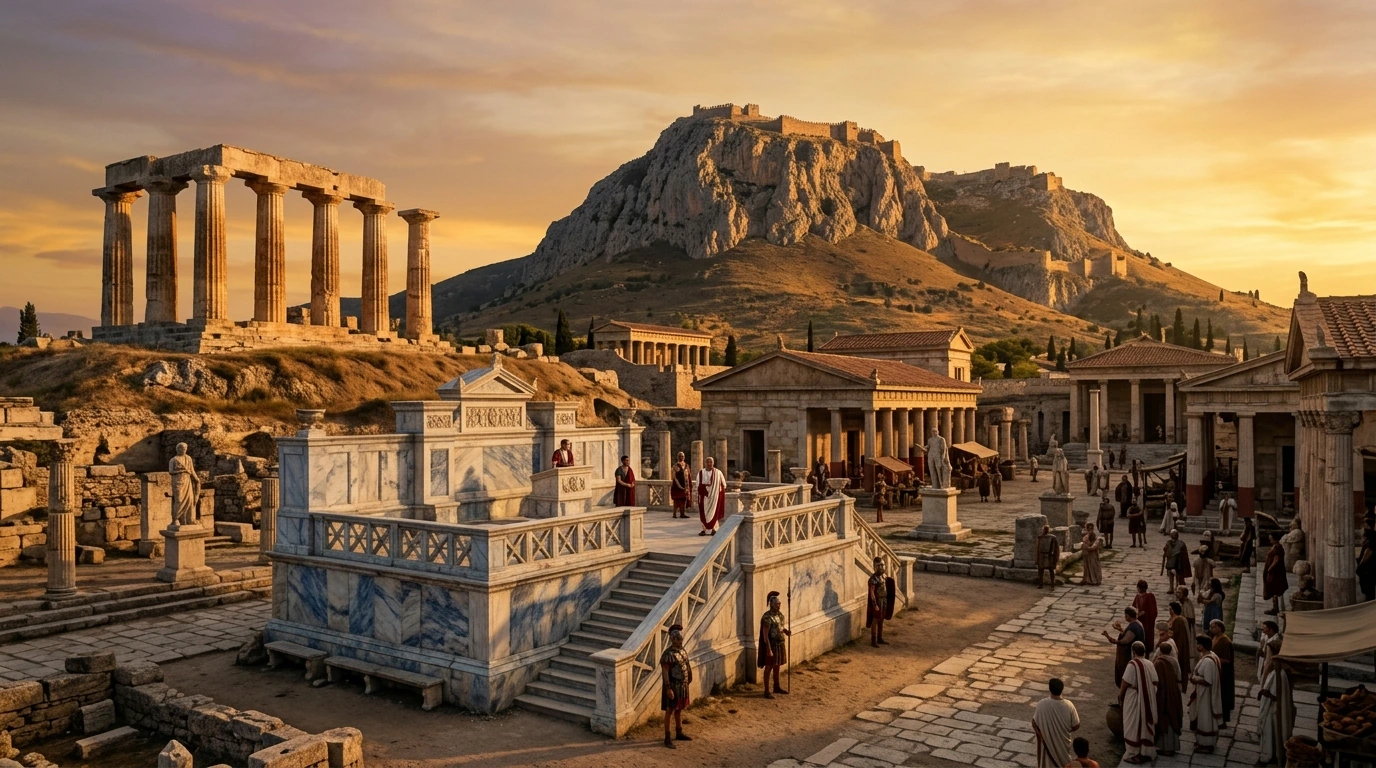
How the Gallio Inscription and the Corinthian Bema Prove the Historical Accuracy of the Book of Acts