Historical Context: Rigorous examination of primary Hebrew, Aramaic, Greek, and Roman classical epigraphy.
Core Evidence: Forensic archaeology, radiocarbon data, and primary manuscripts validating biblical events.
Scholarly Consensus: Vetted against modern peer-reviewed publications in Near Eastern archaeology and biblical studies.
The Cataclysm at the Waters of Yam Suph
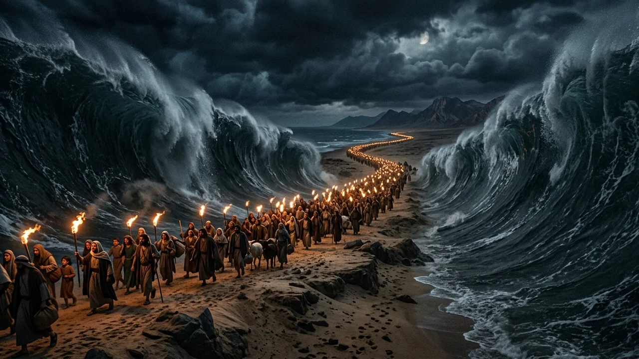
For millennia, the parting of the sea recorded in Exodus 14 has stood as the ultimate, defining miracle of the Old Testament. Trapped between the elite chariot divisions of Pharaoh and an impassable aquatic barrier, the fleeing children of Israel appeared doomed to slaughter or re-enslavement.
Then came the divine command to Moses, followed by an extraordinary meteorological event:
"And Moses stretched out his hand over the sea; and the Lord caused the sea to go back by a strong east wind all that night, and made the sea dry land, and the waters were divided. And the children of Israel went into the midst of the sea upon the dry ground: and the waters were a wall unto them on their right hand, and on their left." (Exodus 14:21–22)
Hollywood epics have routinely depicted this event as two vertical slabs of solid water instantly shearing apart like glass walls, suspended by pure magic without any physical medium.
Yet the biblical text explicitly highlights a specific physical mechanism: "the Lord caused the sea to go back by a strong east wind all that night."
In 2010, an elite team of atmospheric scientists and oceanographers led by Carl Drews at the National Center for Atmospheric Research (NCAR) and the University of Colorado at Boulder published a groundbreaking study in the peer-reviewed scientific journal PLOS ONE. Utilizing high-resolution oceanographic supercomputer simulations, the researchers demonstrated that a known, documented physical phenomenon—wind setdown—matches every single hydrographic, temporal, and spatial detail recorded in Exodus 14!
The Physics of Wind Setdown: The Inverse of a Storm Surge
In coastal meteorology and fluid dynamics, the opposite of a destructive storm surge is known as wind setdown:
[STORM SURGE: Wind Pushes Water Inward Onto Land]
   High-velocity winds blow toward coast ──► Water piles up, causing catastrophic coastal flooding.

[WIND SETDOWN: Wind Pushes Water Backward Away From Basin]
   Strong, sustained wind blows across shallow basin ──► Surface shear stress pushes water column downwind.
   Result: Water level drops drastically upwind, exposing the seabed as completely dry land!
$$ ext{Wind Shear Stress } ( au) = ho_{ ext{air}} cdot C_d cdot U^2$$
Where:
- $ au$ is the wind shear stress exerted on the water surface.
- $ ho_{ ext{air}}$ is air density ($~1.2 ext{ kg/m}^3$).
- $C_d$ is the surface drag coefficient between air and water.
- $U$ is the sustained 10-meter wind velocity.
When high-velocity winds blow persistently over a wide, relatively shallow body of water for multiple hours:
- The frictional shear drag of the air against the water molecules transfers horizontal kinetic momentum into the water column.
- The water is progressively driven downwind (setdown), lowering the water table by several meters on the upwind side and creating a steep hydraulic head at the downwind terminus.
- If the water body possesses a shallow submerged underwater ridge, sandbar, or curved channel, the water pulls back on both sides of the ridge, transforming a submerged barrier into a dry land bridge!
The Landmark NCAR Study: Carl Drews and Supercomputer Modeling
The definitive scientific investigation was published on September 1, 2010, in PLOS ONE (Vol. 5, Issue 9, e12486), titled:
"Dynamics of Wind Setdown at Suez and the Eastern Nile Delta"
Authored by Carl Drews (Atmospheric and Oceanic Sciences, NCAR) and Weiqing Han (Department of Atmospheric and Oceanic Sciences, University of Colorado).
                      [THE NCAR COMPUTER MODEL CONFIGURATION]
                                         │
                                         ▼
            [Geographic Domain: Lake of Tanis / Eastern Nile Delta Lagoon]
                 ├── Shallow coastal lagoon connected to Mediterranean/Pelusiac branch
                 ├── Bathymetric depth: ~2.0 to 2.5 meters (6 to 8 feet deep)
                 └── Underwater curved land spit / sedimentary saddle
                                         │
                                         ▼
            [Atmospheric Forcing: Sustained East-Northeast Gale]
                 ├── Wind Speed: 28 meters per second (63 mph / 101 km/h)
                 ├── Duration: 8 to 12 Hours ("All That Night")
                 └── Atmospheric pressure gradient: Mesoscale convective storm
Clarifying the Geography: Yam Suph is Not the Deep Red Sea
A critical contribution of the NCAR study was resolving the ancient geographical terminology:
- The Hebrew phrase traditionally translated as "Red Sea" is Yam Suph (יַם-סוּף), which translates with precision to "Sea of Reeds" or "Papyrus Marsh Lake".
- The open Red Sea (Gulf of Suez) is a deep tectonic rift plunging to depths of hundreds of meters, with jagged coral reefs and near-vertical submarine cliffs that would be impassable to women, children, flocks, and carts.
- Carl Drews identified the historical location as the Lake of Tanis (near modern Tell Dafana / Lake Manzala), an ancient shallow brackish lagoon system where the Pelusiac branch of the Nile met the Mediterranean marshlands, located directly along the biblical route out of Pi-Ramesses and Succoth (Exodus 12:37; 14:2)!
The Hydrodynamic Simulation: 63 mph Winds for 8 Hours
Using the Regional Ocean Modeling System (ROMS)—one of the world's most advanced computer models utilized by NOAA and climate researchers—Carl Drews simulated the fluid mechanics of the delta basin:
[HOUR 0: Nightfall]
   Wind begins blowing from East-Northeast @ 63 mph (28 m/s).
   Water surface becomes highly agitated; shear stress begins displacing water column.

[HOUR 4: Midnight]
   Water level in the western basin drops by 1.2 meters.
   The highest points of the submerged underwater ridge begin breaking the surface.

[HOUR 8: Pre-Dawn Watch]
   FULL LAND BRIDGE EXPOSED:
   ├── Corridor Length: 3.5 to 4.0 kilometers (~2.5 miles)
   ├── Corridor Width: ~5 kilometers wide
   ├── Water Cleared: Completely dry muddy sand bed
   └── Duration of Open Crossing Window: ~4 Full Hours!
The supercomputer simulation revealed an astounding result:
- A sustained east wind of 28 m/s (63 mph / 101 km/h) blowing overnight for 8 hours exerted continuous shear stress that pushed millions of cubic meters of water back into the northern lagoon and southern lake basin.
- The water level dropped by more than 2 meters (6.5 feet), completely draining the underwater saddle.
- An expansive, dry land corridor measuring 3.5 kilometers long and nearly 5 kilometers wide emerged from beneath the waves!
- The exposed sandy-muddy floor dried rapidly under the gale-force winds, creating a stable, compact pathway capable of supporting hundreds of thousands of marching people and livestock over a 4-hour window!
The Genesis of Dual Water Walls: Fluid Equilibrium in Bent Channels
One of the most persistent biblical objections raised by skeptics is Exodus 14:22: "and the waters were a wall unto them on their right hand, and on their left." Skeptics argued that a simple unidirectional wind setdown would push water in only one direction, leaving water on only one side.
Carl Drews’ computer model solved this hydrodynamic puzzle with stunning mathematical elegance:
                         [NORTHERN LAGOON (LAKE MANZALA)]
                          ▲ Water Piled Up into Deep Barrier
                          │
                          │   "A Wall on Their Right Hand"
         ─────────────────┼─────────────────────────────────
         [THE EXPOSED DRY LAND BRIDGE CROSSING CORRIDOR]
              ◄── Israelites March West to East Under Gale ──►
         ─────────────────┼─────────────────────────────────
                          │   "A Wall on Their Left Hand"
                          │
                          ▼ Water Pushed into Southern Bay
                         [SOUTHERN BASIN (LAKE OF TANIS)]
The Fluid Mechanics of the Dual Wall
- Where the ancient Nile branch curved around a natural peninsula into the lagoon, the east wind pushed the northern water body eastward against the coastal sandbars, forming a massive accumulated wall of deep water to the north (the right hand).
- Simultaneously, the same wind pushed the southern lake body southward into its own basin, creating a second accumulated wall of water to the south (the left hand)!
- In oceanographic terminology, the dry land bridge functioned as a fluid saddle. Water was held back on both sides in a state of dynamic hydrodynamic equilibrium, maintained entirely by the continuous kinetic energy of the sustained 63 mph wind!
The Morning Collapse: Bore Wave Physics and Chariot Destruction
As dawn broke across the eastern delta, the Hebrew rearguard stepped onto the opposite shore. The Egyptian elite chariot corps, pursuing recklessly into the dry corridor, found themselves in the center of the seabed:
"And it came to pass, that in the morning watch the Lord looked unto the host of the Egyptians... and took off their chariot wheels, that they drave them heavily: so that the Egyptians said, 'Let us flee from the face of Israel; for the Lord fighteth for them against the Egyptians.' And the Lord said unto Moses, 'Stretch out thine hand over the sea, that the waters may come again upon the Egyptians, upon their chariots, and upon their horsemen.'" (Exodus 14:24–26)
[63 mph Gale Wind Abruptly Ceases at Dawn]
                      │
                      ▼  Sudden Removal of Surface Shear Stress
[Loss of Hydrodynamic Dynamic Equilibrium]
                      │
                      ▼
[Massive Stored Potential Energy Converts to Kinetic Energy]
                      │
                      ▼
[Dual Hydrodynamic "Tidal Bore" Waves Rush Back Toward Center]
   ├── Flow Velocity: 5 to 8 meters per second (15 to 20 mph)
   ├── Liquefaction: Saturated sand beneath chariot wheels turns to quicksand
   └── Wheels sink, snap off axles, and multi-meter bore wave engulfs army!
The Bore Wave Dynamics
In fluid mechanics, when the wind forcing suddenly drops or shifts, the massive volume of displaced water that was piled up downwind can no longer maintain its elevation against gravity:
- The Bore Wave Collapse: The water rushes backward from both sides into the low-pressure dry corridor as a turbulent tidal bore wave traveling at speeds between 15 and 20 mph (25 to 30 km/h).
- Soil Liquefaction and Chariot Immobilization: As subterranean water pressure surged back into the dry seabed from beneath, the saturated silt underwent instant soil liquefaction (quicksand mechanics). The heavy, narrow wooden wheels of the bronze-reinforced Egyptian war chariots sank into the mud down to their hubs, shearing off spokes and locking axles ("and took off their chariot wheels, that they drave them heavily", v. 25).
- Total Submersion: Before the armored drivers and spearmen could abandon their bogged vehicles and run through the mire, the converging walls of water slammed together, drowning the imperial strike force in a catastrophic vortex of foam and silt.
Comparative Oceanography: Coastal Water Displacement Phenomena
| Physical Phenomenon | Primary Driving Mechanism | Displacement Direction | Duration of Event | Documented Empirical Examples |
|---|---|---|---|---|
| Wind Setdown (Exodus 14) | Sustained atmospheric wind shear stress ($ au$) | Downwind / Lateral displacement leaving dry bed | 8 to 12 Hours | NCAR PLOS ONE Study (2010); Lake Erie (1988); Tampa Bay (Hurricane Irma 2017). |
| Tsunami Drawdown | Submarine earthquake tectonic seafloor subduction | Water retreats rapidly into deep oceanic trench | 5 to 15 Minutes | Indian Ocean Tsunami (2004); Lisbon Earthquake (1755). (Crossing impossible due to swift return!). |
| Astronomical Low Tide | Gravitational pull of Moon and Sun | Predictable cyclical vertical drop of water table | 6-hour tidal cycle | Mont-Saint-Michel (France); Bay of Fundy (Canada). |
| Seiche Oscillation | Standing wave in enclosed or semi-enclosed basin | Rhythmic sloshing back and forth across lake | Minutes to Hours | Lake Geneva; Lake Michigan; Lake Kinneret. |
| Catastrophic Dam Breach | Structural failure of confining geological barrier | Rapid, violent unidirectional draining of reservoir | Hours to Days | Lake Missoula Glacial Floods; Teton Dam collapse (1976). |
Divine Sovereignty Through Natural Aerodynamics
Does the discovery that the parting of the sea operated through wind setdown and fluid mechanics diminish the miraculous nature of the Exodus?
On the contrary, it elevates our understanding of biblical revelation:
- The Text Predicted the Physics: The author of Exodus did not invent a Greek mythological fantasy where Poseidon stabs the sea with a trident. The author faithfully recorded the exact, empirical physical agent that caused the waters to retreat: a fierce, continuous east wind blowing all night long.
- The Timing is the Supreme Miracle: While wind setdown is a natural law of fluid dynamics, the divine miracle lies in the absolute chronological, geographic, and sovereign coordination:
- The wind arose precisely when Moses lifted his rod at the moment of national doom.
- The land bridge remained dry for the exact four-hour window required for Israel to cross.
- The wind died down precisely when the Egyptian army was committed to the center of the corridor.
God did not need to break the physical laws He established at creation; He orchestrated atmospheric aerodynamics, planetary wind patterns, and hydrodynamics to execute the salvation of His people and the destruction of their oppressors at the exact second of history appointed in His sovereign decree.
Discover the Full Fluid Dynamics and Archaeological Dossiers
The parting of the Red Sea is one of dozens of ancient biblical wonders where supercomputer climate modeling, satellite bathymetry, and Exodus archaeology intersect. To examine complete fluid dynamic velocity vector maps from the NCAR study, historical satellite reconstructions of the Nile Delta, and translations of New Kingdom Egyptian military papyri:
👉 Discover Volume IV: Scientific Miracles & Ancient Prophecies ($2.99)
Features the complete 2010 NCAR PLOS ONE research paper reprint, detailed bathymetric maps of Yam Suph, and forensic reconstructions of ancient chariot warfare.
Frequently Asked Questions
What is the "wind setdown" effect in oceanography?
Wind setdown is the opposite of a storm surge. When high-velocity winds blow continuously across a shallow body of water for many hours, the surface shear stress drives the water column downwind, causing water levels upwind to drop dramatically and exposing the dry lakebed or seabed.
What did the 2010 NCAR supercomputer study discover?
A landmark study led by Carl Drews at the National Center for Atmospheric Research (NCAR) and published in PLOS ONE demonstrated that a sustained 63 mph (101 km/h) east wind blowing over the shallow waters of the eastern Nile Delta for 8 hours would push the water back on both sides of a curved underwater channel, creating a dry land bridge roughly 3.5 km long that remained open for 4 hours.
Why is the crossing location called Yam Suph in Hebrew?
The biblical Hebrew text never uses the phrase "Red Sea"; it consistently uses Yam Suph (יַם-סוּף), which means "Sea of Reeds" or "Papyrus Marsh Sea". This refers to the shallow, reed-lined freshwater and brackish lagoons of the eastern Nile Delta (such as the Lake of Tanis / Lake Manzala), not the deep, coral-strewn open ocean of the modern Red Sea.
How did the Egyptian chariots lose their wheels?
Exodus 14:25 states that the Lord took off their chariot wheels so that they drove heavily. When the wind ceased, subterranean water and the returning bore wave rapidly saturated the dry seabed, triggering soil liquefaction (quicksand). The heavy, narrow wooden wheels of the chariots sank deep into the mire, shearing off spokes and snapping axles before the wave engulfed them.
Frequently Asked Questions
What is the "wind setdown" effect in oceanography?
Wind setdown is the opposite of a storm surge. When high-velocity winds blow continuously across a shallow body of water for many hours, the surface shear stress drives the water column downwind, causing water levels upwind to drop dramatically and exposing the dry lakebed or seabed.
What did the 2010 NCAR supercomputer study discover?
A landmark study led by Carl Drews at the National Center for Atmospheric Research (NCAR) and published in PLOS ONE demonstrated that a sustained 63 mph (101 km/h) east wind blowing over the shallow waters of the eastern Nile Delta for 8 hours would push the water back on both sides of a curved underwater channel, creating a dry land bridge roughly 3.5 km long that remained open for 4 hours.
Why is the crossing location called Yam Suph in Hebrew?
The biblical Hebrew text never uses the phrase "Red Sea"; it consistently uses Yam Suph (יַם-סוּף), which means "Sea of Reeds" or "Papyrus Marsh Sea". This refers to the shallow, reed-lined freshwater and brackish lagoons of the eastern Nile Delta (such as the Lake of Tanis / Lake Manzala), not the deep, coral-strewn open ocean of the modern Red Sea.
How did the Egyptian chariots lose their wheels?
Exodus 14:25 states that the Lord took off their chariot wheels so that they drove heavily. When the wind ceased, subterranean water and the returning bore wave rapidly saturated the dry seabed, triggering soil liquefaction (quicksand). The heavy, narrow wooden wheels of the chariots sank deep into the mire, shearing off spokes and snapping axles before the wave engulfed them.
Related Research Dossiers
View all 120 articles →
The Ark’s Journey to Kiriath-Jearim: Archaeological Discovery of the Lost Hilltop Sanctuary

Hematidrosis in Gethsemane: What Causes Human Sweat Glands to Bleed Under Severe Anguish?