Historical Context: Rigorous examination of primary Hebrew, Aramaic, Greek, and Roman classical epigraphy.
Core Evidence: Forensic archaeology, radiocarbon data, and primary manuscripts validating biblical events.
Scholarly Consensus: Vetted against modern peer-reviewed publications in Near Eastern archaeology and biblical studies.
The Assyrian Storm on the Horizon: 701 BC
In the late 8th century BC, the Neo-Assyrian Empire was the most ruthless, technologically unstoppable military machine the ancient world had ever witnessed. Encased in iron armor, deploying multi-story iron-tipped siege engines, massed archers, and armored cavalry, the Assyrians crushed civilizations with calculated, state-sanctioned terror.
In 701 BC, Emperor Sennacherib marched his imperial host of over 200,000 soldiers down the Mediterranean coast to punish King Hezekiah of Judah for withholding tribute. The Assyrian royal annals (preserved on the Taylor Prism in the British Museum) boast:
"As for Hezekiah the Judahite, who had not submitted to my yoke, forty-six of his strong walled cities and smaller towns without number I besieged and took... As for himself, like a caged bird in Jerusalem, his royal city, I shut him up." — Sennacherib’s Annals (Col. III, lines 18–28)
Sennacherib’s army obliterated the massive Judean fortress of Lachish (graphically immortalized on the famous British Museum Lachish Reliefs) and pivoted north toward Jerusalem.
King Hezekiah understood ancient siege warfare with cold clarity: a fortified city could endure months of assault against the highest stone walls, but without water, an entire population collapses in agony within three days.
The Fatal Vulnerability: The Exposed Gihon Spring
Topographically, ancient Jerusalem (the City of David) was built on a narrow limestone spur flanked by deep ravines: the Kidron Valley to the east and the Tyropoeon Valley to the west. While natural cliffs provided defensive superiority, the city suffered from a fatal Achilles’ heel:
[City of David Fortified Hilltop]
                   │
                   ▼  Steep natural slope downward
[Kidron Valley Floor (Outside City Walls)]
   ├── Gihon Spring (Ain Umm Daraj): Only perennial fresh water source
   ├── Intermittent siphon spring discharging 600,000 m³ annually
   └── Completely accessible to besieging Assyrian cavalry & shock troops!
- Jerusalem’s Only Spring Was Outside the Walls: The Gihon Spring (Ain Umm Daraj), Jerusalem’s sole perennial freshwater source, bubbled up at the base of the Kidron Valley—completely exposed on the exterior of the city fortifications!
- The Double Danger: If Sennacherib encircled the city, the Assyrian army could either drink freely from the spring while starving the Jews, or contaminate the pool with animal carcasses and poison, forcing an unconditional surrender.
Hezekiah held an emergency council of war with his military commanders and civil engineers:
"And when Hezekiah saw that Sennacherib was come, and that he was purposed to fight against Jerusalem, He took counsel with his princes and his mighty men to stop the waters of the fountains which were without the city: and they did help him. So there was gathered much people together, who stopped all the fountains, and the brook that ran through the midst of the land, saying, 'Why should the kings of Assyria come, and find much water?'" (2 Chronicles 32:2–4)
Hezekiah’s defense strategy required an unprecedented feat of subterranean civil engineering: block, seal, and camouflage the Gihon Spring from the outside world, and carve a secret, subterranean bedrock canal deep beneath the mountain to divert the entire river inside the city walls!
The Impossible Engineering: 533 Meters Through Solid Meleke Bedrock
The biblical Book of Kings summarizes this monumental civil engineering project in a single sentence:
"And the rest of the acts of Hezekiah, and all his might, and how he made a pool, and a conduit, and brought water into the city, are they not written in the book of the chronicles of the kings of Judah?" (2 Kings 20:20)
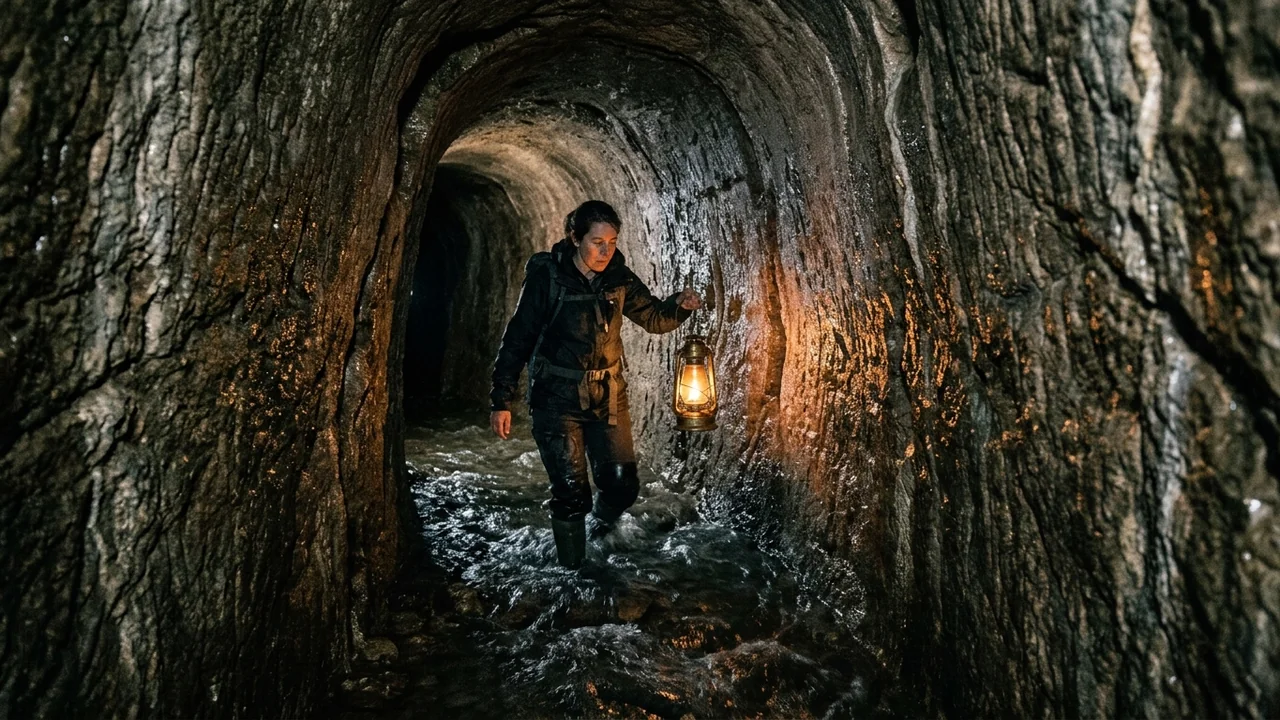
What 2 Kings describes as "a conduit" is in reality the Hezekiah Tunnel (or the Siloam Tunnel)—one of the most astonishing hydraulic and geotechnical engineering feats of the ancient world.
[Gihon Spring (North)] — Elevation: 635.80 meters
          │
          │  533 meters (1,750 feet) of serpentine S-curve tunneling
          │  Carved through solid Meleke limestone by two opposing teams
          │  Overall Elevation Drop: Only 32 centimeters (0.06% gradient!)
          ▼
[Pool of Siloam (South)] — Elevation: 635.48 meters
Technical Specifications
- Total Length: 533 meters (1,749 feet)—despite the straight-line distance between the spring and the pool being only 320 meters (1,050 feet). The tunnel snakes through the rock in an extraordinary, sweeping S-curve.
- Rock Stratum: Carved directly through dense, crystalline Meleke limestone (the famed "royal stone" of Jerusalem) and hard Turonian limestone.
- Microscopic Hydraulic Gradient: Over more than half a kilometer of tunnel, the floor drops by only 32 centimeters (12.6 inches)—a slope of merely 0.06% (0.6 meters per kilometer)!
- If the slope were too steep, the rushing water would cause severe floor erosion and turbulence.
- If the slope were too flat, water would stagnate, silt up, and cease to flow.
- To achieve this gradient underground without lasers, surveying transits, or electricity is a masterclass in ancient hydraulic physics!
Subterranean Navigation: Acoustic Sounding vs. Karstic Fissures
The most mind-boggling aspect of Hezekiah’s Tunnel is that it was excavated by two separate teams of miners working simultaneously from opposite ends—one starting at the northern Gihon Spring, the other at the southern Pool of Siloam—until they met in the middle beneath the mountain!
How could two teams, digging blind in pitch-black darkness deep inside solid limestone, navigate a curving course and meet head-on without missing each other?
[North Team Churning South]                     [South Team Churning North]
            └── Iron Picks & Lanterns                       └── Iron Picks & Lanterns
                            │                               │
                            ▼                               ▼
                 [Limestone Barrier Narrows to < 1.5 Meters (3 Cubits)]
                                            │
                                            ▼
                    [ACOUSTIC DIRECTIONAL SOUNDING]
       ├── Heavy hammer blows struck against ceiling and walls
       ├── Low-frequency soundwaves travel through limestone matrix
       └── Miners alter course, homing in on the acoustic resonance!
                                            │
                                            ▼
                         [HEAD-ON BREAKTHROUGH POINT]
The Two Scientific Hypotheses
- Acoustic Directional Sounding (The Acoustic Navigation Theory):
- As the two teams approached each other, laborers struck the bedrock walls with heavy bronze or iron hammers.
- Low-frequency acoustic soundwaves (200–500 Hz) propagate remarkably well through solid limestone.
- By pressing their ears against the rock face in the silence of the tunnel, master miners tracked the stereophonic sound of the opposing team's picks, curving their course to intercept the source of the noise.
- The Geological Karst Fissure Hypothesis (Frumkin & Shimron, 2006):
- Geologists Prof. Amos Frumkin (Hebrew University) and Dr. Aryeh Shimron proposed that the miners were following a natural, pre-existing dissolution channel or karstic fissure that already seeped water along natural tectonic fault planes.
- This explains why the tunnel meanders in an S-curve rather than following a straight line: the miners followed the winding path of least resistance where water had already hollowed out microscopic cracks!
The Siloam Inscription: Eyewitness Paleo-Hebrew Discovery
In autumn 1880, a young Arab boy named Jacob Eliahu was wading through the southern exit of the tunnel near the Pool of Siloam. Slipping in the mud, he caught a glimpse of dressed stone and letters incised into the rock wall about twenty feet from the entrance.
When German archaeologist Conrad Schick inspected the wall, he realized they had discovered one of the greatest biblical archaeological artifacts in human history: the Siloam Inscription.
    ┌────────────────────────────────────────────────────────┐
    │          THE SILOAM INSCRIPTION (Paleo-Hebrew)          │
    │         Discovered 1880 — Istanbul Museum No. 1274     │
    │                                                        │
    │   1. ...the tunneling; and this is the story of the    │
    │      tunneling: while the quarrymen were still lifting │
    │   2. their axes, each man towards his fellow, and      │
    │      while there were yet three cubits to cut through, │
    │   3. there was heard the voice of a man calling to     │
    │      his fellow, for there was an overlap in the rock  │
    │   4. on the right and on the left. And when the tunnel │
    │      was driven through, the quarrymen hewed the rock, │
    │   5. each man towards his fellow, ax against ax; and   │
    │      the water flowed from the spring towards the      │
    │   6. reservoir for 1,200 cubits, and the height of     │
    │      the rock above the heads of the quarrymen was     │
    │      one hundred cubits.                               │
    └────────────────────────────────────────────────────────┘
Written in classic, elegant Paleo-Hebrew script identical to the writing style of 8th-century BC Judean scribes, the inscription does not praise King Hezekiah or boast of royal victories. Instead, it captures the raw, human, breathless excitement of the common miners at the exact moment of subterranean breakthrough:
- "While there were yet three cubits to cut through, there was heard the voice of a man calling to his fellow!"
- "The quarrymen hewed the rock, each man towards his fellow, ax against ax!"
- "And the water flowed from the spring towards the reservoir for 1,200 cubits!"
The inscription was chiseled out of the wall in 1890 during the Ottoman period and transported to Istanbul, where it remains on display in the Istanbul Archaeological Museum (Museum Inventory No. 1274).
Comparative Ancient Siege Hydro-Engineering
| Site / Fortress | Commissioning Entity | Era / Date | Engineering Mechanism | Tactical Outcome |
|---|---|---|---|---|
| Hezekiah’s Tunnel (Jerusalem) | King Hezekiah of Judah | 701 BC (Iron Age IIB) | 533-meter subterranean rock-cut aqueduct diverting Gihon Spring inside city | Successful: Jerusalem survived the 701 BC Assyrian siege; Sennacherib retreated. |
| Warren’s Shaft (Jerusalem) | Canaanite / Jebusite Kings | c. 1800–1200 BC (Middle/Late Bronze) | Vertical rock chimney and stepped tunnel accessing spring cave from within walls | Provided internal bucket-access to water; used by David’s men to capture city (2 Sam 5:8). |
| Megiddo Water System | Kings of Israel (Ahab / Jeroboam II) | 9th–8th Century BC (Iron II) | 35-meter deep vertical shaft descending to a 70-meter horizontal gallery to exterior spring | Ensured absolute water security during northern campaigns against Arameans and Assyrians. |
| Hazor Water Tunnel | King Ahab of Israel | 9th Century BC (Iron II) | Massive stepped rock trench descending 46 meters to an underground water table | Kept Hazor self-sufficient during massive sieges until Tiglath-Pileser III destroyed it in 732 BC. |
| Tunnel of Eupalinos (Samos, Greece) | Polycrates / Eupalinos of Megara | 6th Century BC (c. 550 BC) | 1,036-meter straight aqueduct tunnel carved through Mount Kastro by two teams | Famous Greek engineering triumph; built nearly 150 years after Hezekiah’s tunnel! |
Modern Radiometric Verification: Nature 2003 Dating
For decades, radical minimalist biblical critics attempted to dismiss Hezekiah’s Tunnel, claiming that such sophisticated hydraulic engineering was impossible in 8th-century BC Judah and asserting the tunnel was carved centuries later during the Hasmonean (2nd century BC) or Hellenistic eras.
In September 2003, a prestigious multidisciplinary scientific team led by Prof. Amos Frumkin, Dr. Aryeh Shimron, and Dr. Jeff Rosenbaum published a landmark study in the journal Nature (Vol. 425, pp. 169–171), titled "Radiometric Dating of the Siloam Tunnel, Jerusalem":
[Radiocarbon C-14 Dating of Short-Lived Organic Matter in Original Tunnel Plaster]
   └── Fragments of straw, wood twigs, and charcoal trapped during plastering
   └── Calibrated 14C Date: 800 to 700 BC!
                    │
                    ▼
[Uranium-Thorium (U-Th) Dating of Secondary Cave Stalactites]
   └── Crystalline speleothems growing on the roof after tunnel was carved
   └── Absolute Minimum Age Constraint: Established 700 BC!
The scientific conclusions were indisputable:
- Carbon-14 Dating: Radiocarbon dating of pristine straw fragments embedded inside the original waterproof lime plaster sealed on the tunnel walls returned a calibrated date of c. 700 BC.
- Uranium-Thorium Dating: Calcite stalactites that grew on the ceiling of the tunnel after excavation had already begun crystallizing before 650 BC.
The scientific paper in Nature concluded definitively that the Siloam Tunnel is indisputably an Iron Age II construction dating precisely to the reign of King Hezekiah around 701 BC!
The Deliverance of Jerusalem
With the secret tunnel completed and the Gihon Spring sealed, Jerusalem was fortified with living water. When Sennacherib’s siege army encamped against the holy city, Isaiah the prophet declared: "He shall not come into this city, nor shoot an arrow there... for I will defend this city to save it" (Isaiah 37:33–35).
That night, divine intervention struck the Assyrian camp (2 Kings 19:35), decimating Sennacherib’s troops and forcing the emperor to abandon the siege and flee back to Nineveh. Jerusalem stood unconquered—saved by the sovereign hand of the God of Israel and the brilliant, sweat-stained chisels of Hezekiah’s quarrymen.
Discover the Full Hydrogeological and Epigraphic Dossiers
Hezekiah’s Tunnel is one of dozens of ancient biblical wonders where ancient siege engineering, paleo-Hebrew epigraphy, and modern radiometric science converge. To examine complete CAD blueprints of the tunnel's 533-meter trajectory, high-resolution epigraphic tracings of the Siloam Inscription, and Sennacherib’s royal cuneiform prism:
👉 Discover Volume III: The Final Files – Biblical Disasters & Ancient Wonders ($2.99)
Features full transliterations of the Siloam Inscription, geological karst cross-sections of the City of David, and tactical siege maps of the 701 BC Assyrian campaign.
Frequently Asked Questions
How did the two tunneling teams meet underground without modern tools?
Geologists and acoustic engineers propose two primary mechanisms: the miners likely followed an existing natural karst dissolution fissure that guided water through the rock, and when the two teams drew within several meters, they utilized directional acoustic sounding—banging hammers against the ceiling and tracking the resonance of the opposing team's picks to steer toward a head-on breakthrough.
What is the Siloam Inscription?
The Siloam Inscription is an authentic 6-line Paleo-Hebrew inscription discovered in 1880 inside Hezekiah’s Tunnel, just twenty feet from the Pool of Siloam. Written in 8th-century BC Hebrew, it records the dramatic eyewitness account of the miners breaking through the final three cubits of rock, ax against ax, allowing water to flow to the city.
How was the tunnel dated scientifically?
In 2003, a team of geologists published a study in the peer-reviewed scientific journal Nature utilizing dual radiometric dating: Carbon-14 dating of straw trapped in the tunnel's waterproof plaster and Uranium-Thorium dating of calcite stalactites growing on the ceiling. Both tests confirmed the tunnel was carved around 700 BC, exactly matching King Hezekiah's reign.
Why is Hezekiah's Tunnel carved in an S-curve instead of a straight line?
While the straight-line distance is only 320 meters, the tunnel meanders for 533 meters in an S-shape. Geologists believe the miners were following natural weak planes and karstic fissures in the Meleke limestone where subterranean water was already seeping, taking the path of least physical resistance through the mountain.
Frequently Asked Questions
How did the two tunneling teams meet underground without modern tools?
Geologists and acoustic engineers propose two primary mechanisms: the miners likely followed an existing natural karst dissolution fissure that guided water through the rock, and when the two teams drew within several meters, they utilized directional acoustic sounding—banging hammers against the ceiling and tracking the resonance of the opposing team's picks to steer toward a head-on breakthrough.
What is the Siloam Inscription?
The Siloam Inscription is an authentic 6-line Paleo-Hebrew inscription discovered in 1880 inside Hezekiah’s Tunnel, just twenty feet from the Pool of Siloam. Written in 8th-century BC Hebrew, it records the dramatic eyewitness account of the miners breaking through the final three cubits of rock, ax against ax, allowing water to flow to the city.
How was the tunnel dated scientifically?
In 2003, a team of geologists published a study in the peer-reviewed scientific journal Nature utilizing dual radiometric dating: Carbon-14 dating of straw trapped in the tunnel's waterproof plaster and Uranium-Thorium dating of calcite stalactites growing on the ceiling. Both tests confirmed the tunnel was carved around 700 BC, exactly matching King Hezekiah's reign.
Why is Hezekiah's Tunnel carved in an S-curve instead of a straight line?
While the straight-line distance is only 320 meters, the tunnel meanders for 533 meters in an S-shape. Geologists believe the miners were following natural weak planes and karstic fissures in the Meleke limestone where subterranean water was already seeping, taking the path of least physical resistance through the mountain.
Related Research Dossiers
View all 120 articles →
150 mph Ballistics: Why Goliath’s Bronze Helmet Was Useless Against David’s Sling
185,000 Assyrian Soldiers Wiped Out in One Night: The Pathology of Sennacherib's Siege Failure